Maps and Zonings
Maps of Robins, Iowa
Explore the maps of Robins, Iowa, as they related to zoning, business development, corporate city limits, and other views.
Maps of Robins, Iowa
Basic Robins Street Map
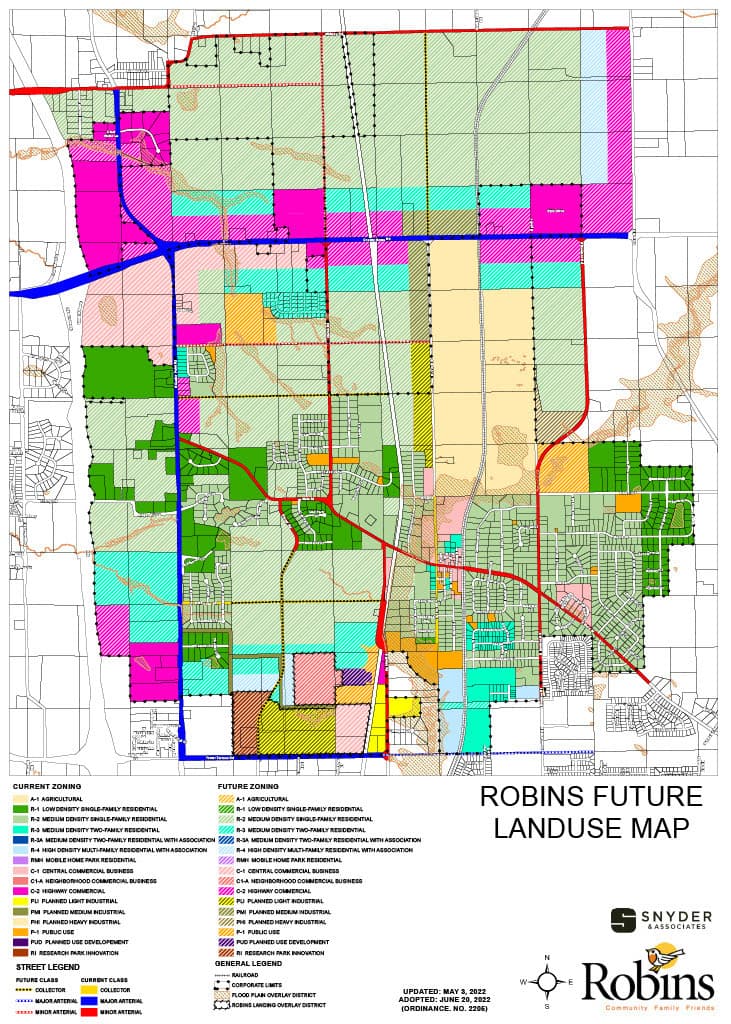
Future Land Use Map
Water System Map
Sanitary Sewer Map
Robins Zoning Details
Zoning Map
Residential, Commercial, & Light Industrial Zoning Ordinances
Important Pages (Ch. 165 | Ord 2505)
R-1, Low Density Single Family: 70-75 | 77-78
R-2, Medium Density Single Family: 76-80 | 78-79
R-3, Medium Density Two-Family: 81-82 | 79-80
C-1 Central Business District: 97-98 | 87-89
C-2 Highway District: 103-104 | 91-93
PLI Planned Light Industrial: 104-106 | 93-94
CHAPTER 165 – ZONING REGULATIONS
Ordinance 2505 Amending Chapter 165
For the most up to date ordinances visit the ordinance page on the City of Robins website.